
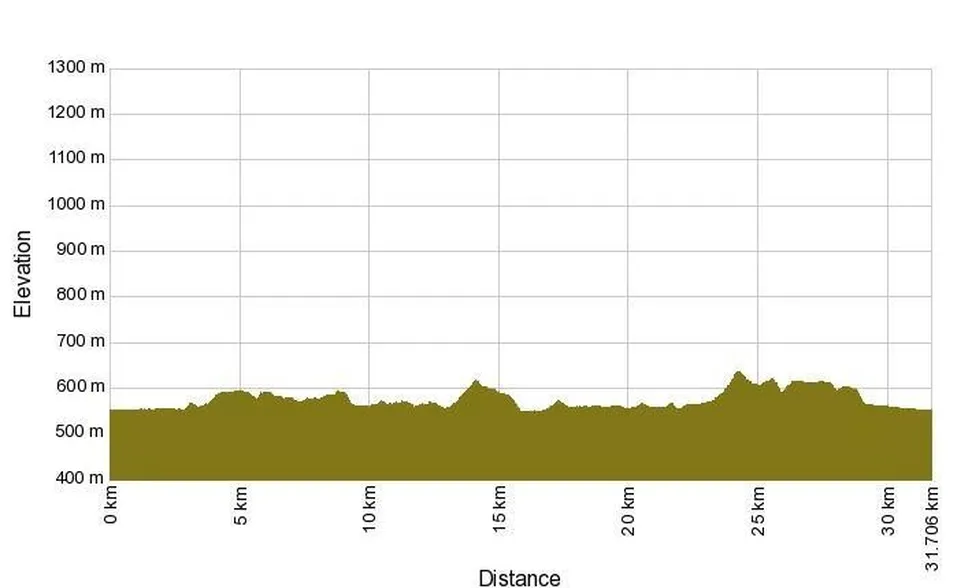
Elevation profile of the path
Download GPX file of the trail
Starting point is at the parking lot at the end of the village of Dolenje Jezero. From here, return towards the village and, at its far end, turn left onto a gravel road towards Dolenja vas. Cross the small bridge there and turn left.
Outside the village, the trail becomes gravel again. At the first crossroads, turn left and continue with a gentle ascent past a viewpoint and above Jamski zaliv bay with the Velika and Mala Karlovica caves. At the end of the climb, at the crossroads, turn left again (towards Otok and Laze pri Gorenjem Jezeru) and pass the ruins of Karlovec Castle above Lake Cerknica.
Along the Javorniki foothills, you will be rewarded several times with magnificent views of Lake Cerknica and Mount Slivnica. After about 15 km in total, you arrive at the village of Laze pri Gorenjem Jezeru, where the asphalt road begins again. From here continue towards Gorenje Jezero, then through the village of Goričice, past Lipsenj and Žerovnica to Grahovo.
When you reach the main road, turn left. You could continue along the main road to Cerknica, but due to traffic, it is not very suitable for cyclists. A better option is to take the parallel road – after about 100 m on the main road, turn right at the church in Grahovo, then after 300 m turn left.
Continue along a gravel road; at the next crossroads, turn left, and immediately left again. This route takes you along the foothills of Mount Slivnica above Martinjak, and after about 4 km you reach Cerknica. From here, gradually descend to the main road, then before the bridge turn left towards Dolenje Jezero to return to the starting point.
A map of all cycling trails in the mystical land of Lake Cerknica can be purchased at the Visitor Center Lake Cerknica for the affordable price of 2.00 €.

