In the summer of 2026, the Karst Research Institute ZRC SAZU, in collaboration with several other institutions, conducted diverse fieldwork. This included the routine collection of hydrological data, supplemented by precise geodetic surveying of bird inventory transects (in cooperation with DOPPS and NRP), as well as the sampling of water and macrophytes in partnership with researchers from China (the Institute of Karst Geology and the Institute of Hydrobiology).
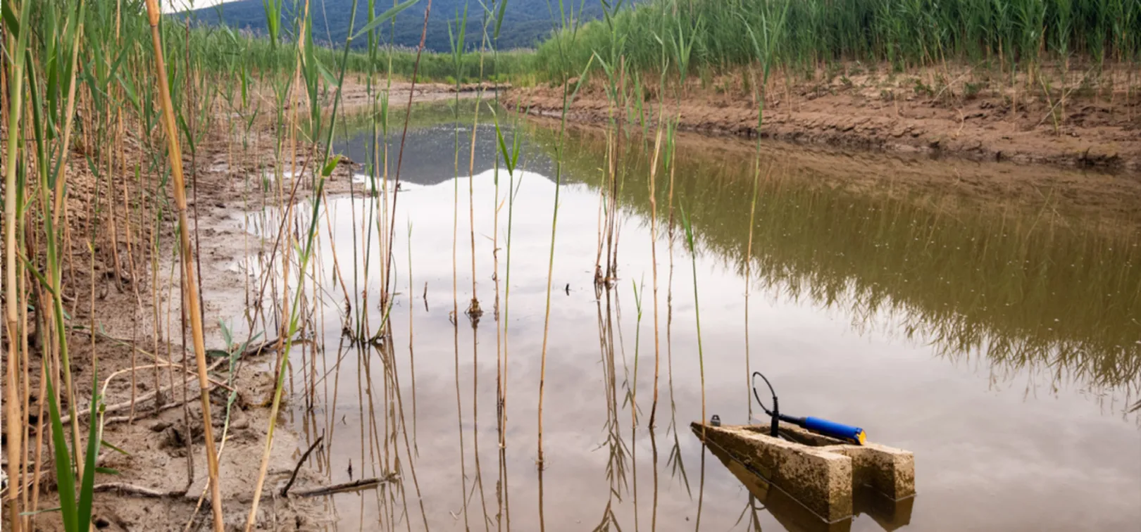
In July, we carried out our regular visit to the “lake windows” site, where continuous water-level and temperature monitoring is established at ten locations. We also visited water active caves Velika Karlovica and Mala Karlovica, where continuous water-level and temperature monitoring is lialso ovserved. After several years of uninterrupted data collection, we encountered issues for the first time—complications that are, unfortunately, quite expected within a complex karst system. In the Stržen stream channel, near its confluence with the Lipsenjščica stream, we discovered ground subsidence; consequently, the current monitoring point sits a few centimeters lower than it did two years ago when measurements began. In Mala Karlovica cave, the monitoring device had been displaced by several meters—we suspect that during one high-water event, the rushing water loosened a bolt to such an extent that the mounting rod completely unscrewed and detached. Fortunately, the device was not entirely lost within the siphon. Newly acquired data have revealed usual patterns of water-level fluctuation, characterized by the fact that individual lake windows exhibit unique dynamics regarding their filling and drying processes.
A concrete block with a data logger, settling into the bed of the Stržen stream.
In mid-August, in collaboration with DOPPS and NRP, we traversed several kilometers across the Cerknica Polje (Cerkniško polje). The primary objective was to precisely measure the elevation of bird survey transects; this data is crucial for understanding the relationship between the terrain of the polje floor, its susceptibility to flooding, and the distribution of specific bird species. While high-quality elevation data is available for most of the polje floor, some survey transects pass through dense reed beds where precise elevation data was previously lacking. To obtain accurate elevation measurements for these transects, we utilized an RTK GNSS antenna while covering a distance of approximately 15 km. As the elevation data obtained is highly valuable, the remaining transects will be surveyed during the next dry period, scheduled for next year.
Detailed geodetic surveying within a dense reed bed along the Žerovniščica stream.
Layout of bird survey transects, with geodetic measurement points marked.
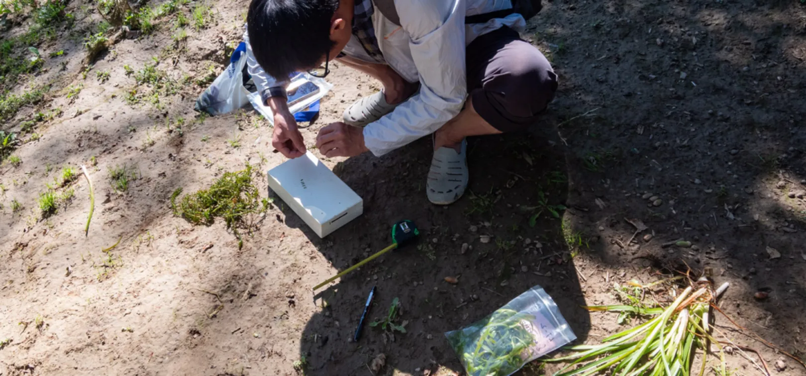
In the autumn, the ZRC Karst Research Institute was once again visited by a group of Chinese researchers from Guilin (Institute of Karst Geology, CAGS) and Wuhan (Institute of Hydrobiology, CAS). Together, we visited several springs across Slovenia, including the Martinjščica and Žerovniščica springs in the Cerknica Polje (Cerkniško polje), as well as the Unica and Obrh springs in the nearby Planinsko and Loško poljes. At these springs, we conducted on site water measurements (temperature, electrical conductivity, pH, and oxygen saturation) and performed rapid tests for carbonate hardness. We also collected macrophyte samples, which will be used for comparison with data from previous years.
Visiting Chinese researchers analyzing macrophyte samples.
All presented field work is crucial for a better understanding of the complex processes occurring within the polje - from water-level fluctuations to the associated distribution of habitat types (including the flora and fauna they support). It is also vital to continue such measurements to monitor the current state and any potential changes.
Article was prepared by the Karst Research Institute ZRC SAZU.
LIFE TRŠCA
With LIFE TRŠCA we will improve the conservation status of the intermittent Lake Cerknica.
The implementation of extensive nature conservation projects exceeds the financial capacity of the local community, therefore Notranjska Park regularly applies for projects with the possibility of co-financing by the European Union.
The implementation of large-scale conservation projects exceeds the financial capabilities of the local community, therefore Notranjska Park regularly applies for projects with the possibility of co-financing from the European Union.