LIFE TRŠCA: About automatic water level instruments

Published: 05. 12. 2025 Author: NRP Categories: Projects

The karst watercourse Stržen is surrounded by grass and reeds on both sides, with a plain and forest in the background, and behind it the Javorniki mountain range under a cloudy sky.
Photo: Rudi Kraševec

Within the framework of the LIFE Tršca project, the ZRC SAZU Karst Research Institute is conducting continuous measurements of water level and water temperature at 10 different locations, which would not be possible without advanced instruments.

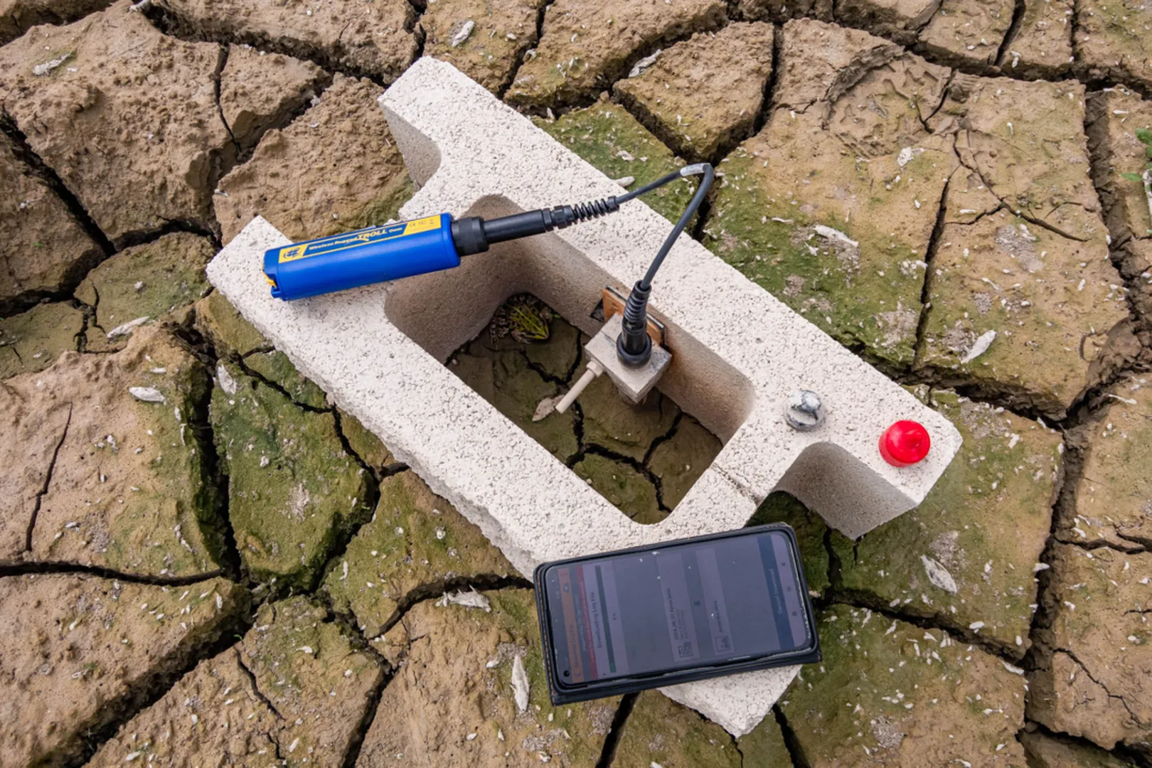
There are quite a few manufacturers on the market dedicated to production of instruments for hydrological observation, which offer a variety of options; from a wide range of measured parameters, battery operation, contactless reading to connectivity to the Internet network. Most of them can be set to the desired time interval for measurements, which are then automatically saved to memory.

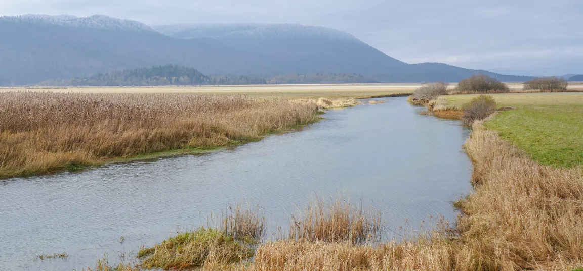
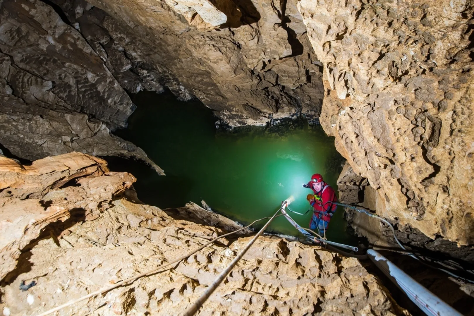
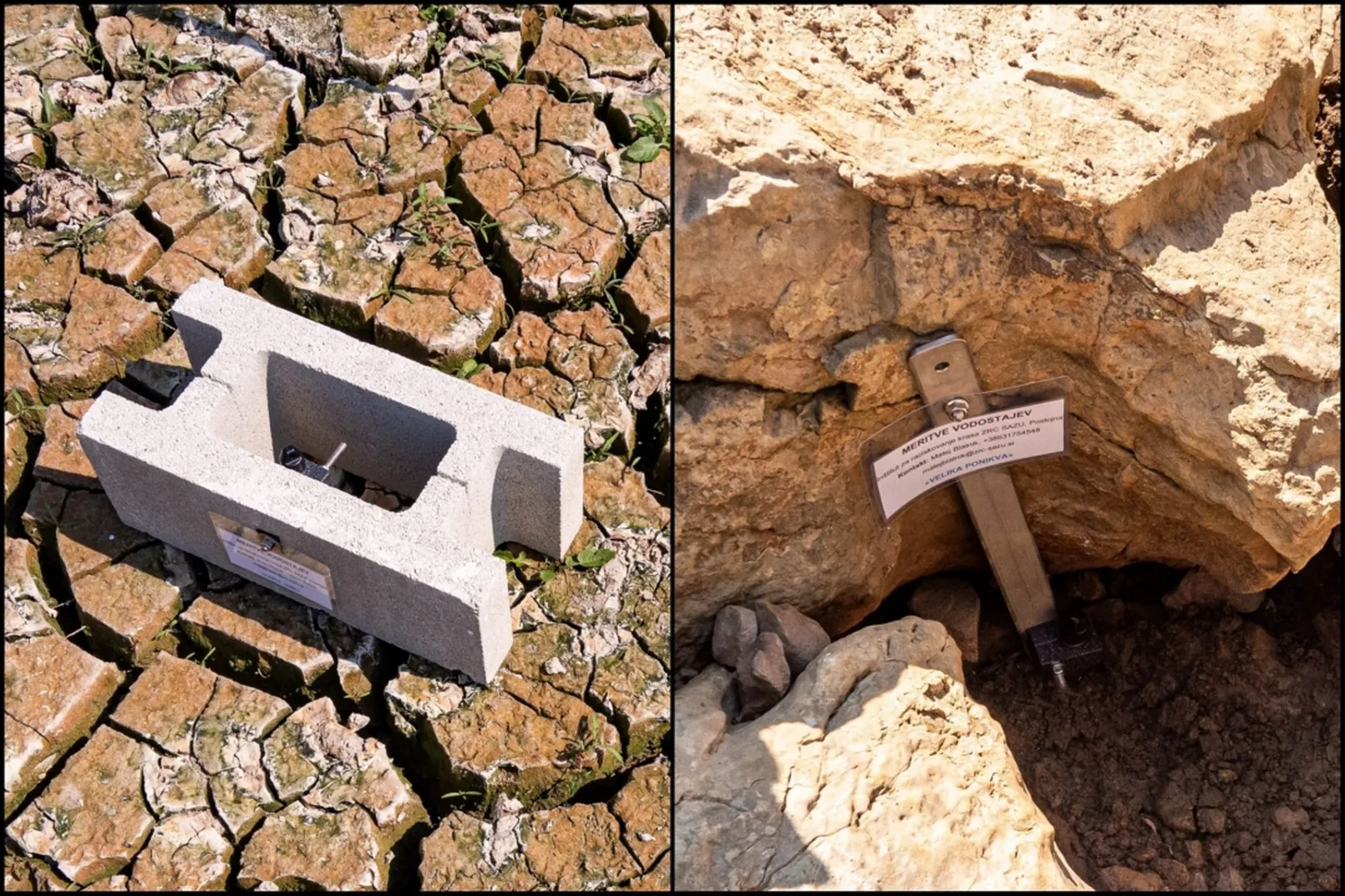
Each environment has certain specificities, and karst environments (especially caves with an access to the groundwater; Figure 1) are characterized by very limited access to electricity or the Internet that enable the most modern methods of measurement and management. In most cases, we therefore rely on meters with their own power supply (battery) and memory, for which the measurement interval is set to such a range that the memory is not yet full and the battery is not empty at the next scheduled visit. Due to the rather demanding environment with pronounced fluctuations in water level, strong and turbulent water flow, the meters must also be robust and firmly mounted on the base.

A caver explores a deep karst cave, standing on the edge of a steep rock face. Using rope equipment and a powerful flashlight, he illuminates a mysterious greenish underground lake hidden in the dark depths of the cave.
Figure 1: Example of a demanding cave environment for hydrological measurements – Matijeva jama.. (Photo: archive ZRC SAZU IZRK)

Although the measuring points in the LIFE Tršca project are not located underground, they are also characterized with some limitations, such as inaccessibility for most of the year due to the presence of water. These measuring points can also be exposed to sediment displacement, the presence of (curious) animals and people, so we also opted for robust instruments with their own memory and battery, which we installed on a solid rock base. Where this was not available, we installed them on heavy concrete blocks (Figure 2).

On the left side of the picture, there is a concrete block with an embedded metal screw and a measuring plate, lying on cracked, dry soil. On the right side of the picture, a metal measuring pin is fixed in the cracked soil, next to it is a white board with the inscription 'WATER LEVEL MEASUREMENT'. Both devices are part of a system for monitoring water levels and water temperature.
Figure 2: Installation of instruments on the rock base and concrete blocks in the summer of 2024. (Photo: archive ZRC SAZU IZRK)

The main observed water properties are the water level (calculated from pressure) and temperature. Such meters on the market have sensors for different depth ranges. The greater the possible measurement depth, the lower the resolution and accuracy. We have installed instruments with a range of up to 30 m depth, which means that they measure with a resolution of 0.3 cm and an accuracy of 1.5 cm. Temperature measurements have a resolution of 0.1 °C and an accuracy of 0.3 °C. As part of some past projects, we also established measurements of specific electrical conductivity, which observe the amounts of dissolved ions in water. Their measurement range is up to 2,500 µS/cm with a resolution of 1 µS/cm and an accuracy of 5 µS/cm. The instruments are started and data is transferred using a mobile phone or tablet via an application and a wireless connection (Figure 3). Since this does not require an internet network, this method is also suitable for the cave environment.

Measuring device for monitoring water levels and water temperature in dry, cracked karst terrain: a concrete block with an embedded metal sensor, connected to a blue electronic device with a cable, next to a smartphone displaying measurement data.
Figure 3: Data transmission with a wireless unit. (Photo: archive ZRC SAZU IZRK)

Installation of instruments and other visits for data transfer or maintenance of the measuring network is usually done in the summer period, when the lake windows are dry. This means that these instruments are also out of the water for some time and therefore they measure air pressure and air temperature. Figure 4 shows a short series of measurements from the Ajnce jame lake window – in the initial period the location is dry and shows pronounced temperature fluctuations, then the water level rises rapidly, and the temperature sensor observes water temperature without daily fluctuations.

We will publish more about water level measurements and the peculiarities of the lake windows in the coming years.

The graph shows data from Ajnce Jama between July 20, 2025 and August 19, 2025: the blue line represents the water level in millimeters, the red line the temperature in degrees Celsius, and the upper part of the graph shows precipitation in millimeters per hour. The water level increases sharply between July 30 and August 9 and then gradually decreases, while the temperature shows daily fluctuations between approximately 10 °C and 35 °C.
Figure 4: Water level and water/air temperature dynamics during temporary ponding of the Ajnce jame.

Article was prepared by the Karst Research Institute ZRC SAZU.

LIFE TRŠCA

With LIFE TRŠCA we will improve the conservation status of the intermittent Lake Cerknica.

Nalaganje...
Projects in the Notranjska Park
Logotip notranjskega parka z rastlino in metuljem.

Projects in the Notranjska Park

The implementation of extensive nature conservation projects exceeds the financial capacity of the local community, therefore Notranjska Park regularly applies for projects with the possibility of co-financing by the European Union.

The implementation of large-scale conservation projects exceeds the financial capabilities of the local community, therefore Notranjska Park regularly applies for projects with the possibility of co-financing from the European Union.

Read more
Read more