LIFE TRŠCA: Determination of inundated areas at selected water level on Cerkniško polje

Published: 10. 04. 2026 Author: NRP Categories: Projects

Aerial view of the lower flow of the Lipsenjščica river, which due to the mosaic mowing also presents a challenge for the precise determination of the inundated areas.

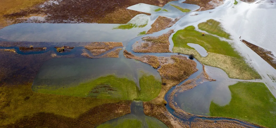
One of the main hydrological tasks during the LIFE TRŠCA project is to define the extent of lake surface of the Cerknica polje in different hydrological states. Several such analyses have been carried out so far, but due to insufficient data, they have all faced certain problems and, to a certain extent, inaccurate results.

One of such studies that was also partially dedicated to determination of lake areas, was also our own study (Blatnik et al. 2022, 2024, 2025), in which some doubts about the quality of results arose due to questionable data about digital elevation model and water level data. The elevation model of the Cerknica polje area obtained by lidar recording is characterized by incorrect values due to the presence of vegetation and the partial presence of water, since the recording was carried out at the time of partial lake formation, and subsequent processing and filtering of the data cannot remove water and low and dense vegetation. Other digital elevation data in lower resolution also do not contain correct values, and has no sufficient spatial resolution for such analyses. Previous analyses have also not taken into account that the water level may be partially inclined in different phases of poljes’ inundation. As a result, the mapping of the lake extent along contour lines is unfortunately not appropriate.

Aerial view of Benetek, which due to the mosaic mowing presents a challenge for the precise determination of the inundated areas.

In the present analysis, we used detailed hydrological data from two official water gauging stations ARSO (Dolenje and Gorenje Jezero) and 11 own hydrological measuring points, which are scattered over a wider area of the polje. Based on several years of measurements, we calculated local deviations in water levels and determined the inclination of the water level at different hydrological situations. In the analysis, we also used a digital elevation model created in 2025, which the Faculty of Civil and Geodetic Engineering of the University of Ljubljana created using photogrammetry at a time when the field was completely dry and most of the vegetation in the field was mowed. In the analysis, we also used satellite images (Planet Labs), mostly those in the infrared spectrum, which show lake areas more clearly. While simultaneously reviewing all data layers on relief, water levels and satellite images, we manually plotted inundated areas at selected hydrological situations, which were determined in 20 cm intervals according to the water gauge at the Dolenje Jezero station.

The result of the analysis are maps and a dataset that contains individual layers (shapefiles) of lake extent at selected water levels. Each layer shows an area that corresponds to the hydrological state according to the measurement at the Dolenje Jezero water gauge station, in 20 cm intervals. The present analysis probably brings the best data information about the lake extent to date, but will certainly be corrected when newer and even better input data become available.

Map of inundated areas at different relative water levels between 40 and 640 cm according to the Dolenje Jezero water gauge.

Article was prepared by the Karst Research Institute ZRC SAZU.

LIFE TRŠCA

With LIFE TRŠCA we will improve the conservation status of the intermittent Lake Cerknica.

Nalaganje...
Projects in the Notranjska Park
Logotip notranjskega parka z rastlino in metuljem.

Projects in the Notranjska Park

The implementation of extensive nature conservation projects exceeds the financial capacity of the local community, therefore Notranjska Park regularly applies for projects with the possibility of co-financing by the European Union.

The implementation of large-scale conservation projects exceeds the financial capabilities of the local community, therefore Notranjska Park regularly applies for projects with the possibility of co-financing from the European Union.

Read more
Read more