Have you ever visited the intermittent natural wonder – Lake Cerknica?
Perhaps you have already observed it from the witch's Mountain, Slivnica? But have you ever seen it from Earth's orbit, where satellites circle?
As part of the LIFE TRŠCA project, we will acquire four satellite images of Lake Cerknica each year, which will contribute to a better understanding of changing water levels and monitoring use. In addition, they will enable remote analysis of the vitality of reed beds, which will contribute to more effective protection of this very special corner of the world.
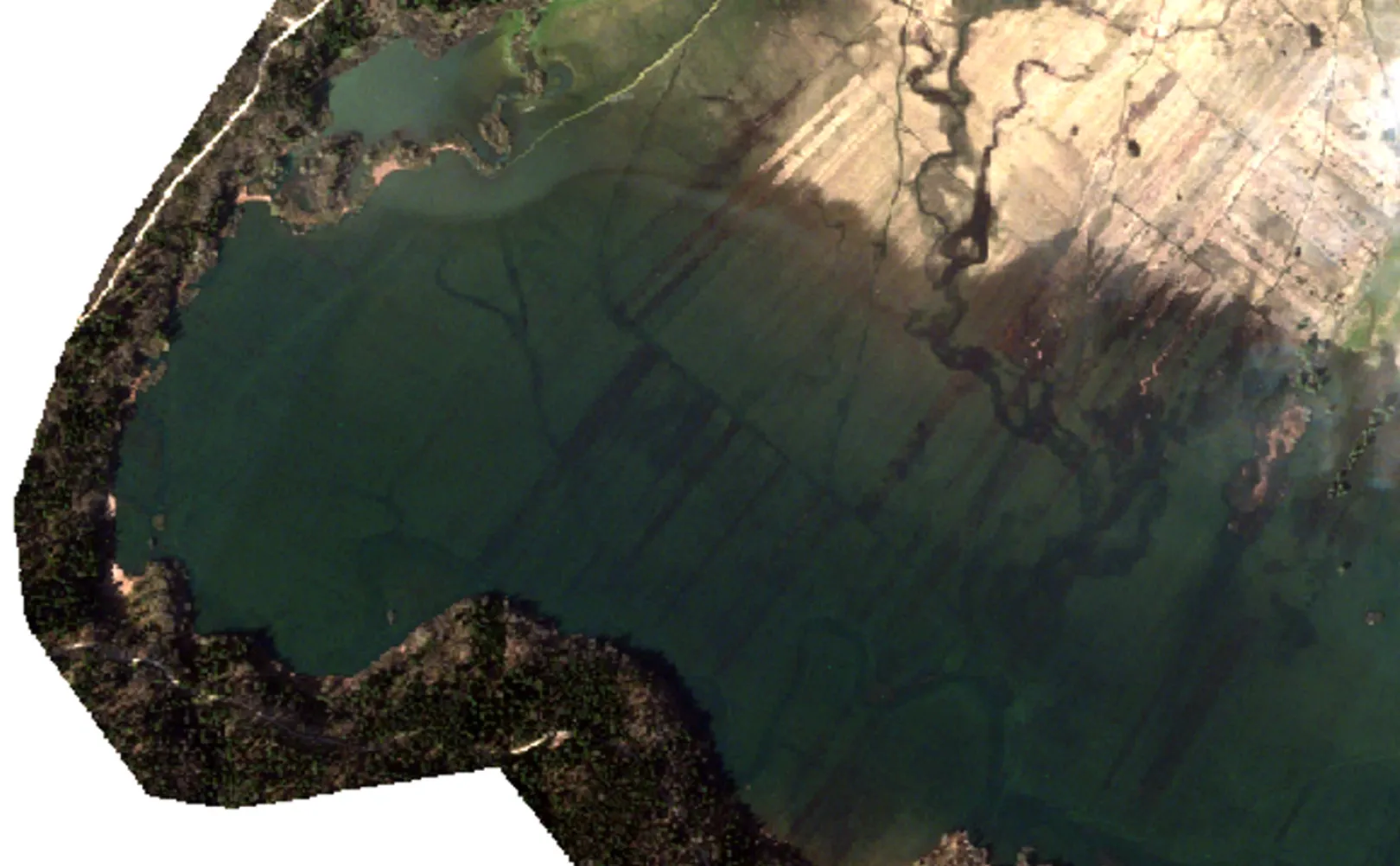
In the photo below is Lake Cerknica, taken on March 30, 2025, when the water level at the Dolenje Jezero measuring station reached approximately 434 cm.
Can you recognize the exposed parts of Lake Cerknica in the photograph?
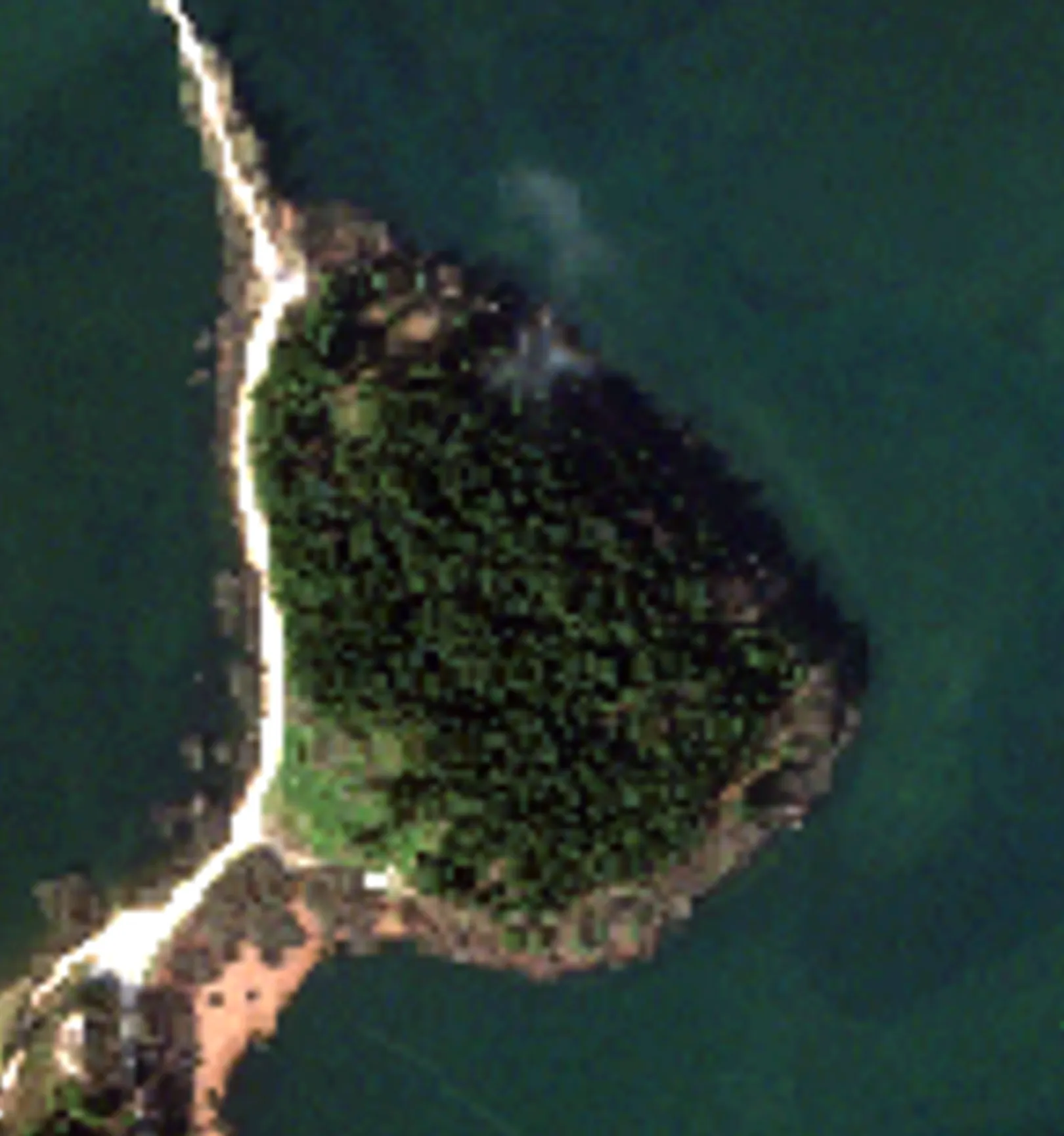
Goričica
Goričica is a forested hill that becomes an island when the lake is full. On its slopes, stone artifacts from the Late Stone Age have been discovered, indicating an existing prehistoric settlement. Visitors can stroll along the oldest Beekeeping educational trail in Slovenia here, which was renovated in 2024 by the Cerknica Beekeeping Association. As part of the LIFE TRŠCA project, demonstration plots for vegetation surveys on Lake Cerknica were installed.
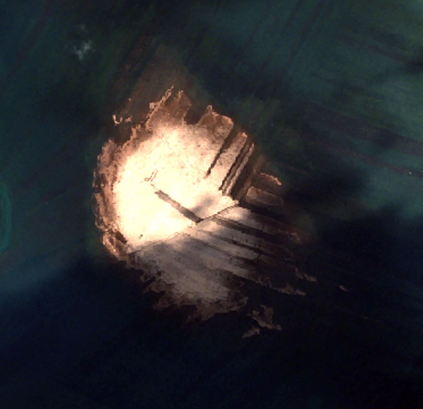
Benetek
Benetek is an area that, even at high water levels, mostly remains above the water surface, but the ground remains heavily saturated even in the deepest droughts, which makes mowing with a tractor very difficult. The reason is its location on slightly higher ground. It is densely overgrown by kopuče (monks), blue cones and other plants, which mostly stay above water and thus provide an important habitat for nesting birds that are safe from terrestrial predators, while also serving as a refuge for various organisms. Because of its remote location and unusual character, it is considered a true research enigma.
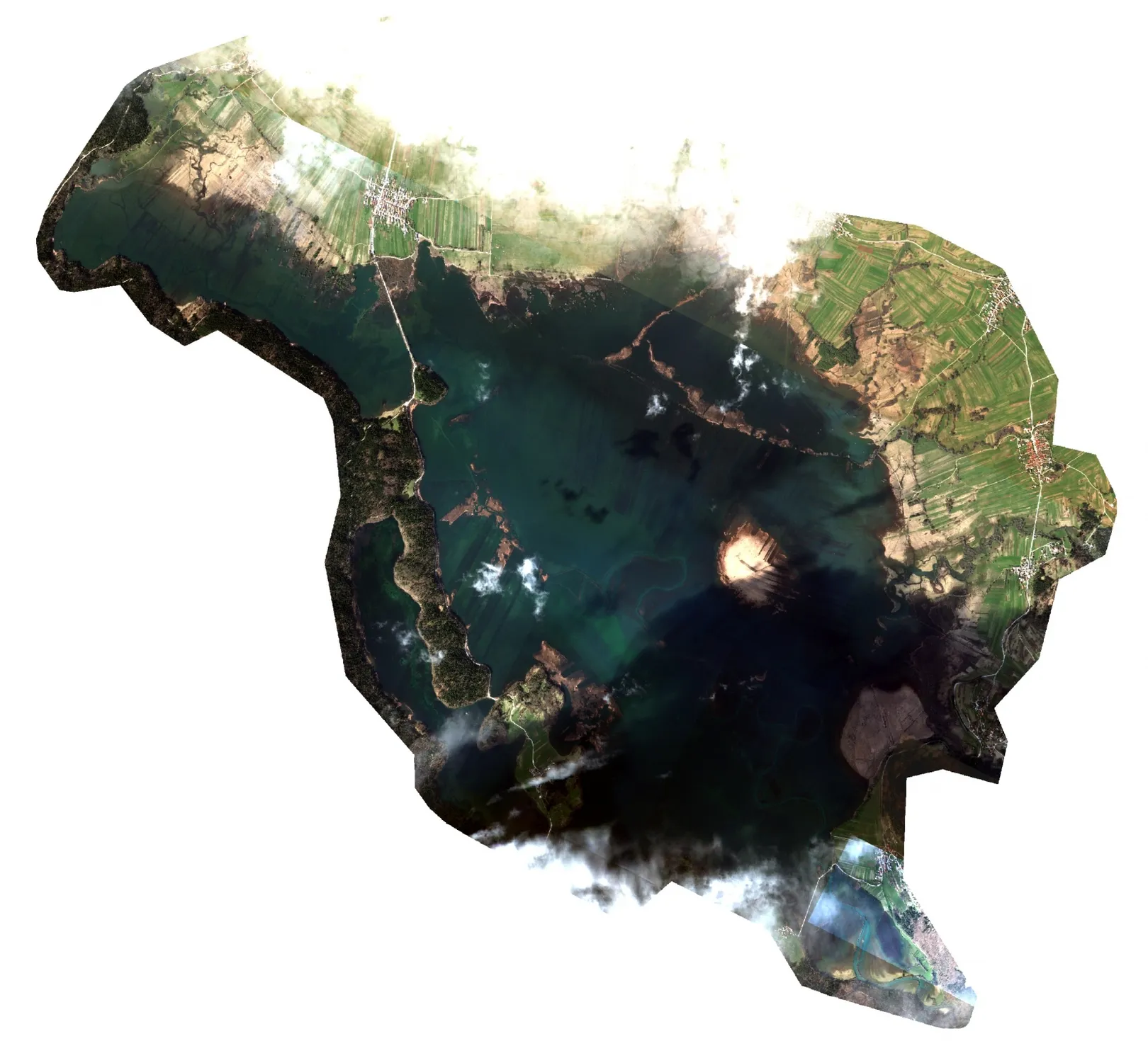
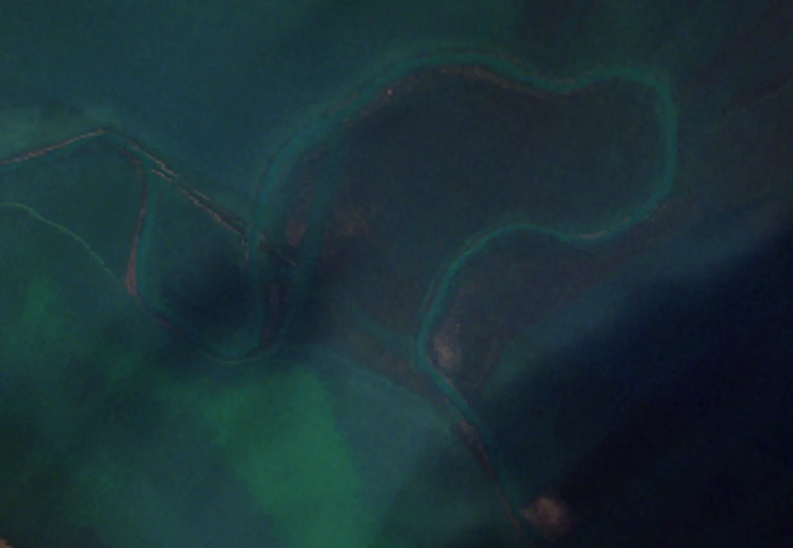
Watercourse Stržen
Stržen is the main watercourse of Lake Cerknica, which was leveled into channels between 1844 and 1958, due to drainage works; the old bends remained as dead arms. As part of the LIFE STRŽEN project, we restored the stream to its original meandering shape in the Beli ključi area, thereby extending its course by 1.5 km and returning the lake its characteristic appearance as it had before human interventions. This improved the living conditions for aquatic organisms and reduced the rate of water outflow from the lake.
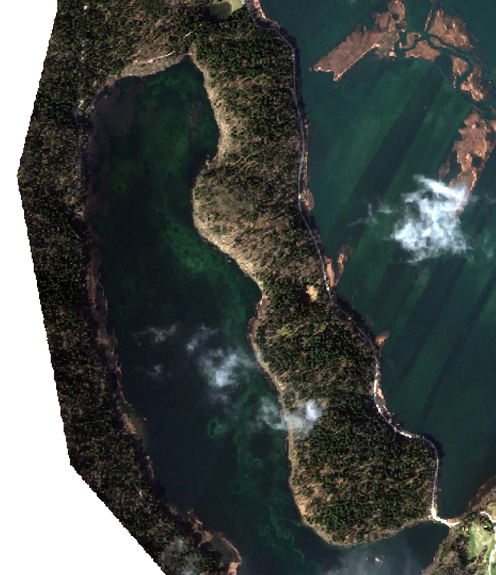
Drvošec
Drvošec is a forested peninsula in the western part of Lake Cerknica, bordered by Zadnji kraj to the south and Trščenke to the north. The award-winning thematic trail Drvošec, one of the most beautiful educational trails in Notranjska Park, runs here. Visitors can observe many bird species from the observation platforms and observation tower. There are also two small marshes – Pocinov and Godešev laz – on the peninsula, where you can encounter the great Triturus vulgaris and other amphibians. Godešev Laz marsh is the only known site of the endemic crayfish Chirocephalus croaticus on the northern side of the Javorniki hills.
Jamski zaliv
Cave Bay is the area of sinkholes, swallow holes and other outlets of water into the underground in the northwestern part of the Cerknica plain. It is characterized by numerous cave entrances in the rocky slopes that lead to the underground karst world, where during drought water from the lake drains toward Rakov Škocjan.
The best way to explore Cave Bay is by canoes, if the water level allows. As part of the Guided Experiences, you can join experienced guides and experience an unforgettable adventure where you will firsthand discover the hidden corners of this karst phenomenon.